Explore the origins and historical contexts behind the names of the Grand Canyon’s various geographical features, including its canyons, buttes, temples, creeks, and points. Delve into the tales linked to explorers like John Wesley Powell, Frank Bond, George Wharton James, Harvey Butchart, and more who left their mark on this majestic landscape.
The Grand Canyon, renowned for its origin and geological significance, is also home to a variety of snake species. You may also like to explore the intriguing world of Grand Canyon snakes, which play a vital role in the canyon’s ecosystem.
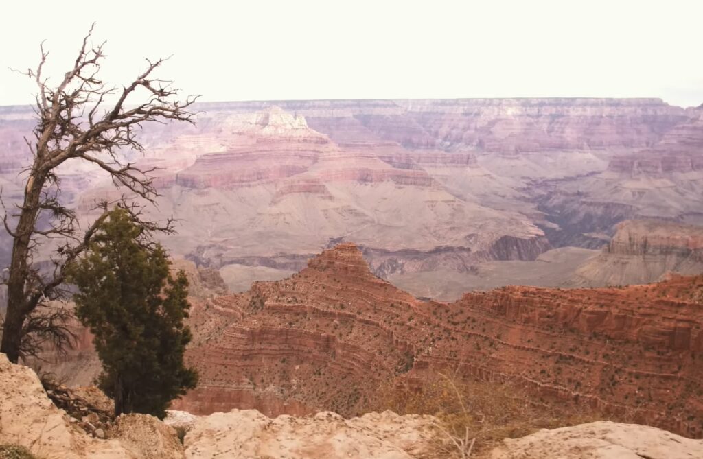
Geographic Features and Historical Names of the Grand Canyon Area
A
- Apache Point: Located on the southern side, southwest of Powell Plateau. This area is named after the Apache Indian tribe.
- Apache Terraces: Situated below Apache Point, characterized by distinct terraced levels;
- Apex: The highest elevation along the Grand Canyon Railroad. This point marks the railroad’s apex;
- Arrowhead Terrace: Identified by Frank Bond, this terrace lies between Stone and Galloway Canyons, beneath Steamboat Mountain. It resembles an arrowhead when viewed from above;
- Aubrey Spring: Found within the Hualapai Reservation beneath the upper rim of the Canyon, named after Francois X Aubrey;
- Ayer Peak (Coronado Butte): A peak east of Hance Canyon, named in honor of Mrs. Ed E. Ayer, the first non-native woman to descend the Grand Canyon at this location.
B
- Babylon Cave: Positioned on the western side of Horseshoe Mesa, close to the Cave of the Domes;
- Badger and Soap Creeks: Two minor, often dry canyons entering Marble Canyon from the north, approximately 10 miles from Lee’s Ferry. Legend says Jacob Hamblin once killed a badger here, leading to an unexpected soap-making incident with the water’s alkali;
- Ballenger: A Mormon settlement by the Little Colorado River, established by Jesse O. Ballenger in 1876, located southwest of Sunset Crossing, east of present-day Winslow;
- Banta Point: Below Atoka Point on the northern side, named for A. F. Banta, General Crook’s chief scout from 1865 to 1871;
- Barbencita Butte: Just above Nankoweap Creek’s mouth, named by Frank Bond after Barbencita, a Navaho chief friendly to John Wesley Powell during his second Grand Canyon expedition;
- Basalt Creek: Named for its geological features, this dry creek and canyon are on the north side, opposite Tanner Beach;
- Bass Station: A former railroad station, named after William Wallace Bass, an early settler and explorer who significantly contributed to the area’s development;
- Bass Point: Known also as Havasupai Point, located on the South Rim, east of Bass Camp, named by George Warton James;
- Bear Headland: On the upper west side of the Coconino Plateau, its shape resembles a bear’s head, named by Frank Bond;
- Bear Spring: A spring where Beale camped, located approximately 4 miles west of where he encountered two men on camels, likely today’s Elden Spring near Flagstaff;
- Big Springs: A U.S. Forest Ranger Station on the Kaibab N.F.’s northwest corner, named for its large springs draining into Nail Canyon;
- Bill Williams Mountain: At 9,264 feet, near Williams, known to the Havasupai as Hue-ga-woo-la (Bear Mountain), named after the scout and hunter Bill Williams;
- Bitter Springs: A spring on the old road to Lee’s Ferry, with notably bitter-tasting waters, located on the west side of Echo cliffs on the Navajo Reservation;
- Black Bill Park: Named after a local figure known as “Black Bill,” this open forest park is northeast of Elden Mountain;
- Black Falls: On the Little Colorado river, named for the dark lava bars over which the river cascades, providing a striking visual during flow periods;
- Black Knob: A distinctive volcanic cone on the Navajo Reservation’s east side, near the Little Colorado River, noted for its isolated and dark appearance;
- Blacktail Canyon: Named by Frank Bond for the black schist visible at its beach, resembling a black tail, located at river mile 120 on the north side;
- Blue Canyon: Home to a Trading Post on the Navaho Reservation, characterized by its blue rock formations;
- Blue Mountain: Noted for its deep blue hue, this mountain is on the eastern edge of the Hualapai Reservation;
- Blue Spring: The largest spring within the Little Colorado Gorge, known for its distinctive blue waters, though its taste is not preferred by many;
- Boucher Creek: West of Hermit Creek, named for “Hermit” Louis Boucher, known for his trail to a copper mine in the area;
- Boulder Narrows: Named for a significant rock in the Colorado River’s current at river mile 18.5, indicative of ancient high water levels;
- Bourke Point: Near Point Imperial, named for Captain John G. Bourke, General Crook’s aide and author;
- Bradley Point: Below Zoroaster Temple, named by Frank Bond for G. Y. Bradley, a member of John Wesley Powell’s 1869 expedition;
- Brady Peak: Below Vista Encantada on the Cape Royal Road, named for Arizona pioneer Peter R. Brady;
- Bridge of Sighs: A natural bridge named by the Kolb Brothers, located along the Colorado River downstream from South Canyon;
- Bright Angel Bridge: A 1970 construction over the Colorado River near Bright Angel Creek, supporting a water pipeline to the South Rim;
- Bright Angel Creek: A creek flowing from near the North Rim to the Colorado River, its name coined by John Wesley Powell to contrast the nearby Dirty Devil stream;
- Broadway Mesa (Bodaway Mesa): On the Navajo Reservation, west of Echo Cliffs, with “Bodaway” being the correct Piute term;
- Buckskin Mountains (Kaibab Plateau): On the North side of the Grand Canyon, renamed for the abundant buckskin obtained from its trophy-size Mule deer;
- Burkes Tanks: Named by Erastus Snow for Hubert Burke, located on the Little Colorado River southwest of Grand Falls;
- Butchart’s Notch: A shortcut on the Escalante Route, providing a faster and more thrilling route than its alternative.
C
- Cameron: A town named after Ralph H. Cameron, located on the south side of the Little Colorado River;
- Cameron Trail: Originally named for Ralph H. Cameron, this trail was initially built to access his copper mines, later renamed Bright Angel Trail;
- Cane Canyon: Not present on current maps, this canyon and stream run northeast into the Colorado River, named for its cane or reeds;
- Canyon de Chelly: A dry wash for most of the year, named after the Navaho word “Tschegi,” meaning “among the cliffs” or associated with ghosts or evil spirits;
- Cape Royal: The southern tip of the Wahalla Plateau, offering extensive views, originally called Greenland Point;
- Cape Solitude: Overlooking the confluence of the Colorado and Little Colorado Rivers, a secluded spot favored by Edward Abbey;
- Cardenas Butte: Below Lipan Point, named for Don Garcia Lopez Cardenas, a captain under Coronado who was among the first Europeans to see the Grand Canyon;
- Cardenas Creek: A usually dry wash beginning at Cardenas Butte, sharing its name;
- Castle Butte: Resembling a vast castle, located on Hopi land near Tuba City;
- Cataract Canyon: Known for its beautiful blue waterfalls within the Havasupai reservation, previously called “Rio de San Antonio” and “Cascade Creek.”;
- Cave of the Domes: A cave off the side of Horseshoe Mesa;
- Cedar Mountain: Visible from Desert View, covered in cedar, with an elevation of 7,057 feet;
- Cheyava Falls: In upper Clear Creek, named by Ellsworth Kolb for its Hopi meaning of intermittent flow, visible from the South Rim during specific seasons;
- Chiavria Point: Named for Juan Chavria, a Maricopa Chief, located above upper Lava Creek;
- Chikapanagi Mesa: Between Olo and Matkatamiba Canyons, named for a Havasupai friend of W. W. Bass;
- Chuar Creek: Flows into Lava Creek, named for a Kaibab Indian chief known as “Chuar” or “Frank” by whites;
- Clear Creek: A significant creek with year-round flow, beginning west of Cheyava Falls, home to spawning trout;
- Clement Powell Butte: West of Bright Angel Creek, named for Clement Powell, the second Powell expedition’s assistant photographer;
- Coanini Creek (Havasu Creek): Named by Powell, important for its source in the San Francisco Mountains;
- Cochise Butte: Named after the Apache Chief Cochise, located above Kwagunt Creek;
- Cocks Comb: A unique ridge between North and South Canyons, resembling a rooster’s comb, located in the eastern edge of the Kaibab Forest;
- Coconino County: Named for the Havasupai term meaning “little water.”;
- Coconino Station: A former railroad station eight miles from the Grand Canyon;
- Coconino National Forest: Established from previous forest reserves, named after the Coconino Plateau;
- Coconino Plateau: A broad geological feature on the South side of the Grand Canyon, named in 1892;
- Coconino Point: Overlooking the Little Colorado along Highway 64;
- Colorado River: Named for its red coloration, the river has undergone various names throughout history;
- Colter Butte: Named for James G. H. Colter, located below Atoka Point;
- Commanche Point: Also known as Bissel Point, situated on the Palisades between Desert View and the Little Colorado;
- Cope Plateau: Named after a paleontologist, exact location unspecified;
- Cranberry Canyon: Provides a route to Deer Creek and the Colorado River, named by David Mortenson;
- Cremation Canyon: The starting point is at Shoshone Point, used historically for offering the dead to the canyon;
- Crossing of the Fathers: A ford on the Colorado River, also known as Ute Crossing, used historically by various groups including Spanish priests;
- Cub Headland: Named by Frank Bond, resembling a bear cub, located on the west side of the Coconino Plateau.
D
- Dana Butte: A prominent headland visible from the Powell Memorial on the South Rim;
- Danta Headland: Its shape resembles a tapir’s head, located on the west side of the Coconino Plateau’s upper reach;
- Dellenbaugh Mount: Named for Frederick S. Dellenbaugh, an artist and historian on Powell’s second expedition, located on the Shivwits Plateau;
- DeMotte Park: Named after Professor Harry C. DeMotte, located along Highway 67 in the North Kaibab National Forest;
- Desert View Point: Offers views of the Navajo Reservation, location of the Watchtower, initially called Navajo Point;
- Desert View Watchtower: Inspired by Anasazi and Pueblo architecture, designed by Mary Jane Colter in 1932;
- De Vargas Terrace: At the Powell Plateau’s southern end, named after an officer with Coronado;
- Diamond Canyon: Explored by Ives and Newberry in 1857, now called Diamond Creek, a popular takeout point for river trips;
- Dove Springs: Located north of the Kaibito Plateau on the Navajo Reservation, known for its visiting dove flocks;
- Dox Castle: Named for early visitor Miss Virginia Dox, located south of Flint Creek;
- Dunn Butte: Named for William H. Dunn of Powell’s first expedition, located northeast of Lyell Butte;
- Duppa Butte: Named for pioneer Bryan P.D. Duppa, located above Kwagunt Creek;
- Dutton Point: Named for geologist Clarence E Dutton, located on the east side of the Powell Plateau.
E
- Ebert Mountain: Possibly named after Lieutenant Abert of the Emory party, found on the 1927 Tusayan National Forest Map;
- Echo Cliffs: Extending south from Lee’s Ferry on the Navajo Reservation, named by John Wesley Powell;
- Echo Peaks: Notable for its echoes, opposite Lee’s Ferry, climbed by Powell’s party in 1871;
- Ehrenberg Point: Named for Hermann Ehrenberg, located on the north side, southeast of Point Imperial;
- Elephant Butte: A distinct lava plug visible from Highway 160 outside Tuba City;
- El Tovar: The renowned hotel at the South Rim Village, named for Don Pedro Tovar of the Coronado expedition;
- Escalante Butte: Below Lipan Point, accessed by the Tanner Trail, named after Father Escalante;
- Escalante Creek: Flows into the Colorado River, dry most of the time, named after Father Escalante;
- Espejo Butte: Midway between the Little Colorado River and Desert View, named for explorer Antonio Espejo;
- Esplanade: Described by geologist Clarence Dutton, a vast expanse of bare rock beginning near the South Bass Trail;
- Excalibur Tower: Named after King Arthur’s sword, located east of the Powell Plateau, resembling a sword handle.
F
- Feroz Terrace: This area, descending west from the north side of Powell Plateau, resembles a dragon in appearance. Frank Bond named it, possibly located between Galloway and Stone Canyons;
- Fiske Wall: A grand wall formation named in honor of John Fiske, a noted scientist;
- Flagstaff: Named after a flagpole erected by military personnel at Leroux Spring in 1858, the town grew around this symbolic spring and flagpole, initially known as Old Town Spring;
- Flax River: Another name for the Little Colorado River, derived from the flax plants along its banks, used by early explorers and named for its significance to local agriculture;
- Flint Creek: Originating west of Point Sublime and flowing into Shinumo Creek, named for the flint formations found along its path, this creek has a constant flow of high-quality water;
- Forest Lagoons: Named by Ives, these are temporary lakes on the Hualapai Reservation, created by floodwaters in the pine forests north of Pine Springs;
- Fossil Canyon: A vast amphitheater with extreme heat in summer, explored by Harvey Butchart, featuring dry conditions except for occasional water sources discovered by Allyn Cureton and Jim Ohlman;
- Fourmile Spring: A small, now-dry seep located four miles from the Hermit Trail head, west of Grand Canyon Village, just beyond Santa Maria Spring;
- Franklin Heaton Reservoir: A water source found in 1865 by settler Franklin Heaton, situated on the southern end of Hurricane Ledge, east of Cooper Pockets;
- Fredonia: Established in 1865, this community became a refuge for Mormons practicing polygamy, with its name symbolizing freedom for these families.
G
- Gannet Tower: Named after Henry Gannet by James, though its specific location is not provided;
- Gatagama Terrace: Named in honor of a Havasupai Indian Family, located off the northwest side of the Great Thumb;
- Geike Monument: Named by G. Wharton James for a renowned British geologist, resembling a lion in repose, located south of the canyon below Drummond Point;
- Ghost Rock: West of Deer Creek, named for the natural white figures beneath an overhang, discovered by George Billingsley;
- Gilbert Terrace: Honors C. K. Gilbert, a geologist who explored the area with the Wheeler expedition, reaching up to Diamond Creek along the Colorado River;
- Glen Canyon: Described by Powell during his exploration, stretching from the Paria to the San Juan River confluence, now mostly submerged under Lake Powell;
- Glen Canyon Dam: Constructed between 1956 and 1963, this dam created Lake Powell, extending 180 miles upstream from Lee’s Ferry;
- Grand Canyon: The village at the South Rim, evolving around a spring and flagpole, initially named Hances’s Tank, now known as Grand Canyon Village;
- Grand Canyon Forest Reserve: Established in 1893, it originally included lands on both sides of the canyon, later divided into the Kaibab and Coconino National Forests;
- Grand Canyon National Park: Founded in 1919, incorporating Marble Canyon and Grand Canyon National Monuments, with adjusted boundaries including the Havasupai Reservation;
- Grand Canyon of the Colorado River: Coined by Powell, spanning 238 miles from the Little Colorado River confluence to Nonnow Valley;
- Grand Cliff Range: Also known as the Grand Wash Cliffs, marking the western boundary of the Hualapai Reservation;
- Grand Falls: A magnificent waterfall near Leupp, where the Little Colorado River cascades over lava cliffs, especially dramatic in spring or after monsoons;
- Grand Gulch: A significant canyon starting on Cedar Mesa in Utah, flowing into the San Juan River;
- Grand Scenic Divide: A high divide south of the Colorado River, named by James, with its head at Darwin Plateau;
- Grand View Point: Named by the U.S.G.S., this point offers expansive views and is the start of a trail leading to historic copper mines and the Colorado River;
- Grand Wash: A deep gorge extending from Mount Bangs to the Colorado River, creating a striking natural corridor;
- Granite Gorge: Starts at Hance Rapid, extending 41 miles along the Colorado River, showcasing profound geological features;
- Granite Park: Situated in the western Grand Canyon below Hualapai land, this open area is rich in Anasazi ruins and historical routes;
- Granite Peak: A prominent feature in the Hualapai Mountains;
- Grapevine Canyon: Known for the grapevines at its head, this canyon has multiple locations, including one flowing into the Colorado River and another near Pearce Ferry, offering water sources in dry times;
- Great Thumb Mesa: Named by Frank Bond, this mesa on Havasupai Land resembles a gigantic thumb, standing out on the north end of the Coconino Plateau;
- Great Thumb Trail: An ancient Havasupai Trail descending from Great Thumb Mesa to the Esplanade, featuring a spring that was once a crucial water source.
H
- Hackberry: Situated west of Peach Springs, originally known as Garden Spring, renamed for its proximity to a notable hackberry tree;
- Hacks Canyon: Named after Haskell “Hack” Jolly, a horse breeder who utilized a spring in the canyon, with a uranium mine once operational here;
- Hall Butte: Located south of Wotans Throne, named by Frank Bond for Andrew Hall, a member of Powell’s first expedition;
- Hamblin Creek: Named for Jacob Hamblin, an early Mormon missionary, this creek flows into Moenkopi Wash, originating from the Echo Cliffs;
- Hance Creek: Named for John Hance, the South Rim’s first permanent settler, who also improved an Indian route into the Old Hance Trail;
- Hancock Butte: South of Point Imperial, named for Captain William A. Hancock, an early pioneer who surveyed Phoenix;
- Hansbrough Point: Named in memory of Peter M. Hansbrough, who drowned near House Rock Rapid, marked by a point directly opposite Eminence Break;
- Hardscrabble: The original name for Fredonia, Arizona;
- Hattan Butte: Near Bright Angel Creek, named for Andrew Hatton, a hunter and cook on Powell’s second expedition;
- Havasupai Indian Reservation: Established for the “People of the blue green water” in 1880, its boundaries expanded in 1975, known for its deep cultural history and beautiful waterfalls;
- Havasupai Point: East of Bass Camp on the South Rim, named by George Wharton James;
- Havasu Canyon and Creek: The lower section of Cataract Canyon, visited by Padre Garces in 1776, known for its stunning blue-green waters;
- Hawkins Butte: Named for W. R. Hawkins, a member of Powell’s expedition, located near Angels Gate;
- Hayden, Mount: Named for Charles T. Hayden, an Arizona pioneer, located below Point Imperial;
- Hermit Basin: Accessible from Hermit’s Rest, named after Louis P. Brown, a prospector known as the “Hermit” who lived in the area in the 1890s;
- Hillers Butte: Below Buddha Temple, named for John K. Hillers, the photographer on Powell’s second expedition;
- Hopi Indian Reservation: Established for the Hopi Tribe, known for their ancient settlements and unique cultural heritage;
- Hopi Indians: Known for their longstanding history, the Hopi have lived in the area since around 1200, with Oraibi being one of the oldest continuously inhabited settlements in the U.S;
- Hopi Point: A popular sunset viewing spot on the West Rim Drive, named for the Hopi Tribe;
- Horseshoe Mesa: Below Grandview Point, named for its shape, with historical copper mining operations by Pete Berry;
- Hot Na Na: A narrow canyon near House Rock Rapid, named in Navajo language, meaning “narrow place.”;
- House Rock and House Rock Spring: Named after a makeshift shelter, known as “Rock House Hotel,” near a significant spring, situated north of Highway 89A;
- House Rock Valley: Extending from House Rock Spring to the Colorado River, a natural corridor below the Vermillion Cliffs;
- Howlands Butte: Named for Seneca and W. R. Howland, Powell expedition members, located west of Angels Gate;
- Hualapai Hilltop: The start of the trail to Supai Village, historically used by Padre Garces and now a key access point for visitors and supplies;
- Hualapai Indian Reservation: Established in 1883, home to the Hualapai Tribe, with Peach Springs as its main community;
- Hualapai Indians: Members of the Yuman tribe, originally from along the Colorado River, known as “Pine tree Folk” for their pine-covered reservation;
- Hualapai Mountains: Featuring Hualapai Peak, these mountains are southeast of Kingman, Arizona, offering scenic views and outdoor activities;
- Hubbell Butte: Named for J. Lorenzo Hubbell, a prominent Navajo trader, located southeast of Atoka Point;
- Huethawali, Mount: Below South Bass Trailhead, named with an Indian word meaning “Observation Point.”;
- Humphrey’s Peak: Arizona’s highest peak, near Flagstaff, offering panoramic views of the surrounding landscape;
- Hundred and Fifty Mile Canyon: Known for its challenging rapids, this canyon is a notable point for river runners, also referred to as SOB Canyon by some;
- Hutton Butte: Named for Oscar Hutton, a noted guide around 1870, located southeast of Point Imperial.
I
- Ice Caves: Situated east of the San Francisco Peaks, these caves retain ice year-round, historically used by Flagstaff saloons;
- Indian Gardens: A campsite along the Bright Angel Trail, historically used for agriculture by Native Americans, now a popular stop for hikers;
- Inscription House Ruin: An ancient dwelling near a large coal mine, open to the public with a guide during summer, named for a 17th-century inscription found there.
J
- Jacobs Pools: A spring in the Vermillion Cliffs, named after Jacob Hamlin, an early missionary, providing water for livestock;
- Jacobs Lake: Near Highways 67 and 89A, a seasonal lake on the Kaibab Plateau, supporting a small community with lodging and camping facilities;
- Jeffords Point: Below Atoka Point, named for Thomas J. Jeffords, a pioneer and friend of Apache Chief Cochise;
- Johnson Creek: Flows into Kanab Creek, named for W. D. Johnson, a short-term photographer on Powell’s second expedition;
- Johnson Point: Above Phantom Ranch, named for Fred Johnson, an early park ranger who tragically drowned in Horn Creek Rapid;
- Jones Point: Across from Johnson Point, named for S. V. Jones, a participant in John Wesley Powell’s second Grand Canyon expedition;
- Jump Up Cabin: A historical structure at Jump Up Canyon’s head, built as a Ranger Station in 1906 and reconstructed in 1997 for continued use by hikers and cowboys;
- Jump Up Canyon: A popular hiking destination within Kanab Creek, named for its challenging terrain that includes a climb around a significant fall.
K
- Kabito Plateau: Also home to a spring, situated on the Navajo side of Marble Canyon, named for the willows found there;
- Kaibab Forest: The expansive forest encompassing the North and South sides of the Grand Canyon, originally named Kaibab;
- Kaibab Indian Reservation: A small reservation west of Fredonia for the Kaibab Band of Paiute Indians;
- Kaibab National Forest: Originating as the Grand Canyon Forest Reserve in 1893, its headquarters are now in Kanab, Utah;
- Kaibab Plateau: North of the Grand Canyon, named by the Indigenous people, known for its high elevations and lush forests;
- Kaibab Suspension Bridge: Also known as the Black Bridge, constructed in 1928 to transport materials across the Colorado River;
- Kanab Creek: Named after the Piute word for willow, this creek flows from Utah into the Colorado River, often dry in sections;
- Kangaroo Headland: Features an outline resembling a kangaroo, located on the west side of the Great Thumb Mesa;
- Kayenta: A key town near Monument Valley, established around a trading post by John Wetherhill in 1909, named for its historical significance to Native American hunting practices;
- Kibbey Butte: Named in honor of Joseph H. Kibbey, an Arizona pioneer, situated east of Greenland Lake;
- Kivagunt Valley: Identified by Dellenbaugh as a beautiful valley within the Grand Canyon, named by Powell for a Pai-Ute Indian claiming ownership;
- Kwagunt Creek: South of Nankoweap, known for its permanent water flow and historical significance, with numerous archeological sites;
- Kwagunt Hollow: A tributary of Kanab Creek known for its water, campsites, and route out of the Canyon, named after a Pai-Ute Indian.
L
- Lava Creek: Originating south of Atoka Point, named by the U.S.G.S., this creek flows directly into the Colorado River;
- Lava Falls: Known for its intense rapids, located past mile 179 on the Colorado River, this area is challenging for hikers and river runners alike;
- Lee Canyon: Named after John D. Lee, it merges with Havasu Canyon, with the Topocoba Trail following its course, commemorating Lee’s time with the Havasupai;
- Lees Ferry: A crucial crossing point on the Colorado River established by John D. Lee, serving as a ferry point until the completion of the Navajo Bridge;
- Lees Ferry Bridge: Also known as Navajo Bridge, it connects areas over the Colorado River, with the original bridge now serving pedestrian traffic;
- Le Fevre Canyon: Named for a family that grazed sheep in the area, located on the western side of the Kaibab Plateau;
- Leroux Spring: An early explorer’s camp near Flagstaff, named for guide Antoine Leroux, marking a significant historical site;
- Limestone Tanks: Waterholes in a limestone formation, located south of Lees Ferry on Highway 89, providing a critical water source in the desert;
- Little Nankoweap Creek: A typically dry creek just north of Nankoweap Creek, representing the area’s complex drainage system.
M
- Manzanita Creek: Named for the prevalent scrub, this creek begins off the Walhalla Plateau, flowing into Bright Angel Creek near Cottonwood Campground;
- Marble Canyon: Hosts a small community and serves as the gateway to Marble Gorge, defined by Powell as distinct from both Glen and Grand Canyons;
- Marble Gorge: Distinguished by Powell for its unique geology, this section of the river between the Paria and Little Colorado Rivers is known for its marble-like formations;
- Marcos Terrace: Overlooking the Esplanade, named for Spanish Padre Fray Marcos by the U.S.G.S., celebrating the area’s rich history;
- Maricopa Point: On the West Rim, this point is named for the Maricopa Tribe, highlighting the connection between the land and its Indigenous peoples;
- Marion Point: Situated on the Nankoweap Trail, named for pioneer John H. Marion, it reflects the area’s pioneering history;
- Marsh Butte: Named for paleontologist Professor Marsh by George Wharton James, situated on the south side of Granite Gorge;
- Matakatamiba Canyon: Known for its water sources and popularity among river runners, named for a Havasupai family;
- Merriwitica Canyon: A side canyon on the Hualapai Reservation, its name reflects the area’s Indigenous heritage and linguistic challenges;
- Millett Point: Honoring artist Frank Millett, this point is a tribute to a notable figure lost on the Titanic;
- Moenkopi Wash: Flows from Black Mesa to the Little Colorado, named for its continuous water flow, reflecting the Hopi language;
- Mohawk Canyon: Originates on the Hualapai Reservation, flowing into the Colorado River, known for its seasonal dryness;
- Mooney Falls: A stunning waterfall named after prospector James Mooney, marking a site of historical significance within Havasu Creek;
- Moran Point: Named for artist Thomas Moran, this viewpoint offers breathtaking vistas of the Canyon, showcasing its inspirational beauty;
- Mount Hayden: Named for Ferdinand Vandiveer Hayden, this peak is a testament to the American West’s exploration;
- Mount Trumbell: Named by Powell for Senator Lyman Trumbell, its timber contributed to the construction of the Mormon Temple in St. George.
- Muav Canyon: Originating below Swamp Point, this canyon is linked to Teddy Roosevelt’s hunting expeditions, offering shelter and historical intrigue;
- Mystic Spring: Discovered by W.W. Bass and confirmed by Harvey Butchart, this spring is a testament to the explorers’ efforts to map the Grand Canyon’s resources.
N
- Nail Canyon: Named for an early settler, this canyon flows into Snake Gulch, reflecting the area’s early community and natural resources;
- Nankoweap Creek: Known for its archeological sites and trout spawning, this creek is named for its echo, capturing the landscape’s acoustic properties;
- Natchi Canyon: Named after Cochise’s son, this canyon drains into upper Lava Creek, reflecting the area’s Indigenous connections;
- Naji Point: Situated west of Lava Creek, this point offers a perspective on the canyon’s expansive geology;
- National Canyon: A significant canyon draining into the Colorado River, marking a natural boundary and providing a distinct ecosystem;
- Navajo Bridge: Connecting regions over the Colorado River, this bridge represents a vital infrastructure development, enhancing access and connectivity;
- Navajo Mountain: Visible from Major Powell’s expeditions, this mountain stands as a landmark on the Navajo Reservation, symbolizing the landscape’s grandeur;
- Navajo Spring: An important campsite in early exploration, providing water and rest for travelers south of Lee’s Ferry;
- North Canyon: Running parallel to South Canyon, this dry canyon underscores the region’s diverse and arid landscape;
- Novinger Butte: Named for pioneer Simon Novinger, reflecting the settlement history of the Salt River Valley.
O
- Oak Spring: Located on the Hualapai Reservation, this spring underscores the area’s natural resources and ecological diversity;
- Obi Canyon: A small canyon starting on the Walhalla Plateau, named for its piñon pines, reflecting the area’s flora;
- Ochoa Point: Marks the end of the Basalt Cliffs, named for Esteban Ochoa, a pre-Civil War Tucson businessman, emphasizing historical trade routes;
- Olo Canyon: Known for its horse-related Havasupai name and as a favored river camp, reflecting the canyon’s cultural significance;
- O’Neill Butte: Named for Captain William O. O’Neill, this butte honors a hero of the Spanish American War, linking the landscape to national history;
- O’Neill Spring: Once a vital water source near the Grandview Trail, now dry, this spring is named after Buckey O’Neill, showcasing the changing environment.
P
- Painted Desert: Spanning north and east of the Little Colorado River, this vibrant landscape was first documented by Ives in 1858, despite associations with Coronado. Its colors range from chocolate to grey, as described by Powell;
- Palisades Creek: A dry creek draining from the Palisades of the Desert, located south of Cape Solitude;
- Palisades of the Desert: An impressive geological formation visible from Desert View, extending along the East Rim from Cape Solitude to Tanner Canyon, named by a U.S.G.S. team in 1886;
- Panya Point: Overlooking the junction of Havasu and Lee Canyons, accessible by an old jeep trail from Hualapai Hilltop Road, named for a Havasupai family;
- Papago Creek: Originating west of Tusayan Ruins between 75 Mile and Red Canyons, with Papago Point above it, named for the Papago Indians by Frank Bond;
- Paria River: Flowing from Utah into the Colorado near Lee’s Ferry, this river has year-round flow but is prone to flooding. Its name signifies ‘dirty water’ or ‘Elk water’ in Ute language;
- Paria Plateau: Sitting above the Vermillion Cliffs, filled with Pinon and Juniper trees on red sand, just south of Utah;
- Parishawampitts Canyon: Primarily on the Kaibab Plateau, noted for a bubbling spring and a rarely visited point south of Crazy Jug;
- Pattie Butte: Named by Frank Bond for Sylvester Pattie, the first American to reach the South Rim in 1825, located north of Shoshone Point;
- Paya Point: Near Mount Akaba on the west side of Great Thumb, named for a Havasupai family;
- Peach Springs: A town on Route 66 within the Hualapai Reservation, visited first by Garces in 1776. Named for the nearby springs adorned with peach trees;
- Peach Springs Draw: Stretching from Peach Springs to enter Diamond Creek at Diamond Peak;
- Phantom Ranch: Originally “Rust’s Camp,” established in 1903 for tourists. Renovated and renamed by Mary Jane Colter in 1922, it once featured a swimming pool;
- Pierce Ferry (Pearce): Established by Harrison Pearce in 1876, now a popular takeout point for Colorado River trips on Lake Mead;
- Pine Hollow: Starting near Big Spring in the Kaibab Forest and flowing to the Colorado River;
- Pine Springs: Identified as “Rose Well” by Garces in 1776 for its wild roses, located on the Hualapai Reservation;
- Pipe Springs: On the Kaibab Reservation, a site now preserved as a National Monument, known for its ample, quality water;
- Piute Point: Overlooking Sapphire Canyon, once called Grand View Point, offering panoramic views from an elevation of 6,632 feet;
- Pivot Rock: A spring emerging from a rock, creating a natural water feature described on the 1928 Coconino National Forest Map;
- Plateau of Arizona: An extensive area defined by the Grand Canyon, the Little Colorado, and the Mogollon Rim, inclusive of the San Francisco Mountains;
- Point Imperial: The highest overlook on the southeast side of the Kaibab Plateau at 8,803 feet, offering expansive views across various landmarks;
- Poston Butte: Named for Charles D. Poston, an early pioneer, located east of Lava Creek and below Naji Point;
- Pot Holes: Located in the South Kaibab National Forest, natural depressions retaining water after rainfall, also used historically as corrals;
- Powell, Lake: Named after John Wesley Powell, this man-made reservoir behind Glen Canyon Dam showcases the vastness and impact of human engineering on natural landscapes;
- Powell Plateau: A less-traveled area on the river’s north side, visible from the South Rim Village, named in honor of John Wesley Powell;
- President Harding Rapid: At River Mile 43, named following the death of President Harding in 1923 by a survey camp;
- Prospect Canyon: Named for prospectors Franklin French and John Conners, stretching from the Hualapai Reservation to the Colorado River.
R
- Red Butte: Made of red Moenkopi Sandstone and visible on approach to the South Rim, a natural landmark featuring a trail and fire lookout;
- Red Horse Wash: Draining into Cataract Canyon, named after Garces’s 1776 encampment site, located west of Anita;
- Refuge Cave: A cave used historically as a haven, situated at the rim of Mile 21.7 Wash, rich in archaeological findings;
- Roundy Creek: Named after Bishop Lorenzo Roundy, this creek flows from the Echo Cliffs to the Colorado River, marked by historical significance;
- Rowe Knob: A former geographic name, now potentially identified with modern landmarks, initially named for early prospector Sanford Rowe;
- Rowes Point (Hopi Point): Renamed for its current association with Hopi heritage, originally honoring prospector Sanford Rowe;
- Rowes Well: Near Grand Canyon Village, a historical site named for Sanford Rowe, serving various functions over time;
- Russell Butte: Despite uncertainties about its namesake, this feature in the Grand Canyon possibly honors geologist Russell or a local cowboy;
- Russell Tank: Situated south of Grand View Point, a natural reservoir once stocked with trout, associated with the area’s environmental and recreational uses.
S
- Saddle Canyon: Offering water sources due to its elevation, this canyon begins at Saddle Mountain, flowing into the Colorado River;
- San Francisco Mountains: Sacred to the Hopi and known for their high peaks, these mountains near Flagstaff are named for their historical and cultural significance;
- Sapphire Canyon: One of Powell’s “gems,” named for its location and beauty, nestled west of Boucher Creek;
- Separation Canyon: Commemorating a poignant moment from Powell’s 1869 expedition, this canyon marks the departure of key expedition members;
- Shinumo Altar: A butte resembling an altar, named by Dellenbaugh and associated with the Shinumo, an early branch of the Hopi tribe;
- Shinumo Creek: Known for its historical camps and exploration by W.W. Bass, this creek flows from Big Spring to the Colorado River;
- Shinumo Wash: Provides a historic path from the rim to the river, highlighting the area’s geological and cultural history;
- Shiva Temple: Named for a Hindu deity, this formidable formation was mythologized for its supposed inaccessibility and unique flora and fauna;
- Shivwits Plateau: Located in the Grand Canyon’s west end, known for its high point, Mount Dellenbaugh, and the surrounding water-rich Parashont area;
- Sieber Point: Honors Al Sieber, a respected U.S. Army scout, known for his leadership and tragic death during the Roosevelt Dam construction;
- Silver Bridge: Built near Phantom Ranch in 1968, incorporating a water pipeline, symbolizing modern infrastructure in a remote setting;
- Sinking Ship: Resembling a doomed vessel, this formation near the Buggeln Hill picnic area captivates with its geological storytelling;
- Sinyala Canyon: Named for a Havasupai Chief, this canyon flows to the Colorado River, adding to the region’s rich Indigenous history;
- Sinyala Mesa: Surrounds Mount Sinyala on the Esplanade, offering unique landscapes and ecological diversity;
- Sinyala, Mount: Across from Deadhorse Mesa, this peak stands as a testament to the area’s natural grandeur and historical naming practices;
- Sixtymile Creek: A dry creek ending at the Colorado River, north of Chuar Butte, reflecting the region’s arid conditions;
- Snake Gulch: Known for its winding path and significant pictographs, this gulch showcases the area’s prehistoric culture and natural beauty;
- Sockdolager Rapids: Marking a significant rapid in the Granite Gorge, this feature adds to the Colorado River’s challenging navigational elements;
- South Canyon: Complementing North Canyon, this waterway flows into Marble Canyon, noted for its natural and cultural landmarks;
- Sowats Canyon: Named for a Piute word meaning a plant used like tobacco, this canyon flows into Jump Up Canyon, enriching the area’s ethnobotanical history;
- Specter Terrace: Situated on the Powell Plateau’s southwest side, offering views across the river to Specter Chasm, enhancing the canyon’s mystical allure;
- Spencer Canyon: Named for Charlie Spencer, a guide and prospector, this canyon enriches the western Grand Canyon’s narrative of exploration;
- Spencer Trail: Ascending the Paria Plateau, this trail reflects Charles Spencer’s ambitious gold sluicing efforts and the area’s mining history;
- Steamboat Mountain: Dominating the landscape south of Tapeats Amphitheater, this mountain contributes to the canyon’s rugged topography;
- Sturdevant Point: Commemorating Glen E. Sturdevant, a park ranger who met his end in Horn Creek Rapid, this point adds to the narrative of Grand Canyon explorers;
- Sublime Point: Offering breathtaking views, named by Clarence Dutton, this landmark epitomizes the Grand Canyon’s awe-inspiring beauty;
- Sullivan Peak: Near Point Imperial, honoring J.W. Sullivan, this peak adds to the rich tapestry of Arizona’s pioneering history;
- Sumner Butte: Overlooking Phantom Ranch, named for John D. Sumner, an early explorer, contributing to the canyon’s layered historical narrative;
- Sunset Crater: A volcanic feature near Flagstaff, recognized for its fiery appearance at dusk, encapsulating the region’s volcanic activity;
- Supai: Home to the Havasupai tribe, this village in Havasu Canyon attracts visitors with its breathtaking waterfalls and cultural significance;
- Swilling Butte: Named for J.W. Swilling, an early settler, this butte between Kwagunt and Nankoweap Creeks adds to the Grand Canyon’s mosaic of names.
T
- Tahuta Terrace: Northwest of Great Thumb Point, named for a revered Havasupai woman, reflecting the area’s Indigenous heritage;
- Tanner Canyon: Hosting the Tanner Trail, this canyon’s history is intertwined with tales of prospecting and early cross-canyon travel;
- Tanner Crossing: A historical crossing on the Little Colorado, showcasing the river’s natural challenges and the region’s travel routes;
- Tapeats Creek: A scenic creek originating from Tapeats Cave, contributing vital water to the Colorado River’s ecosystem;
- Tapeats Terrace: West of Steamboat Mountain, this terrace on the Esplanade offers geological interest and scenic beauty;
- Tatahatso Point: Meaning “land that juts out” in Navajo, this point provides strategic views above President Harding Rapid;
- Tenneys Gulch: Named for Ammon Tenney, an associate of Powell, this canyon flows into Kanab Creek, enhancing the area’s historical connections;
- Thompson Canyon: Starting in Little Park and draining into Bright Angel Creek, this canyon is absent from current maps, reflecting changes in geographic knowledge;
- Three Castles (Sinking Ship): A geological formation that has captivated observers with its unique appearance and historical intrigue;
- Thunder River: Emanating from caves, this short but powerful river contributes to Tapeats Creek, showcasing the canyon’s hydrological wonders;
- Topaz Canyon: Between Boucher and Slate Canyons, named for its gem-like qualities, adding to the canyon’s geological diversity;
- Topocoba Hilltop: A historical route to Supai, this trail reflects the area’s travel history and the significance of water sources;
- Tower of Babel: A distinctive butte near Diamond Canyon, contributing to the Hualapai Reservation’s landscape narrative;
- Tritle Peak: Commemorating F.A. Tritle, an early mining entrepreneur and governor, this peak adds to the narrative of Arizona’s development;
- Tuba City: Named for Chief Tuba, this community reflects the intertwined histories of Mormon settlers and Hopi leaders;
- Tucket Canyon: A lesser-known canyon within the Grand Canyon region, reflecting the vastness and diversity of the landscape;
- Turquoise Canyon: Part of Powell’s “gems,” this canyon south of Walapai Point enhances the geological and cultural tapestry of the area;
- Tuweap (Toroweap): Offering unparalleled views of the western Grand Canyon, this area highlights the region’s volcanic history and natural beauty.
U
- Uncle Jim Point: Named for a local pioneer, this point above Roaring Springs Canyon connects personal histories with the grandeur of the landscape;
- Uinkaret Plateau: Named by Powell, this area west of the Kaibab Reservation showcases the diversity of the Grand Canyon’s surrounding regions;
- Upset Rapids: Named after an event involving a 1923 Geological Survey party, this rapid adds to the Colorado River’s challenging navigational features;
- Utah Flats: Above Phantom Ranch, this area’s name reflects its resemblance to Utah’s landscapes, highlighting the region’s diverse topography.
V
- Valle: A developing area south of the South Rim, emphasizing the ongoing impact of human activity on the Grand Canyon region;
- Vaseys Paradise: A lush oasis named for botanist George Vasey, showcasing the Colorado River’s life-sustaining springs and diverse ecosystems;
- Vulcan’s Anvil: A geological feature in the river at mile 178, symbolizing the area’s volcanic history;
- Vulcan’s Throne: Overlooking Lava Falls, named for its commanding presence and geological significance, this cinder cone epitomizes the volcanic forces shaping the landscape.
W
- Wash Henry Trail: An early route for crossing the canyon, reflecting the region’s evolving pathways and exploratory history;
- White Creek: Flowing from Mauv Saddle to Shinumo Creek, this waterway underscores the Grand Canyon’s complex hydrology;
- Whites Butte: Commemorating James White’s controversial journey through the canyon, this butte contributes to the region’s rich narrative of exploration and survival;
- Wickyty-wizz Canyon (Merriwitica Canyon): Reflecting linguistic challenges and Hualapai heritage, this canyon enriches the cultural and geographical understanding of the area;
- Willaha: Named for its water source, this area’s history spans from natural reservoir to railroad station, showcasing the region’s adaptability;
- Whitmore Wash: Named for an early settler, this wash in the western canyon adds to the narrative of human settlement and conflict in the area;
- Wodo Butte (Mount Wodo): Named for a Havasupai family, this feature near Supai Village links the landscape with local Indigenous histories;
- Woolsey Butte: Commemorating King S. Woolsey, this butte near Point Imperial connects the Grand Canyon’s geography with Arizona’s pioneer era.
Y
- Yumtheska Mesa: Overlooking the confluence of Havasu Creek and the Colorado River, named for a Havasupai family, highlighting the interplay of natural beauty and cultural heritage;
- Yunosi Point: Near the Village of Supai, named for a Havasupai family, this point emphasizes the Havasupai’s deep connection to the canyon’s landscape.
Z
- Zuni Point: On the East Rim Drive, named for the Zuni people, underscoring the longstanding presence and influence of Native American tribes in the region.
Conclusion
The Grand Canyon stands as a testament to natural beauty and human history, its names a mosaic of stories from indigenous peoples, explorers, and pioneers. Each toponym in the Grand Canyon reveals a piece of the past, honoring the legacy of those who walked its paths and shaped its history.